Burton K Wheeler
Moderator
This idea popped into my head while I was driving and I thought I'd type it up quick. Sources are my Very Good Brain plus wikipedia for checking dates, so don't expect deep historical rigor here. In particular, I am not in any way a railway nerd, so the train enthusiasts here may have a lot of suggestions I missed.
An Iron Road to Gold: The History of Canada's Northern Railway
The Klondike Gold Rush of 1898-1899 lies at the beginning of our story, as it does at the beginning of nearly every story about Canada's North. Inspired by the riches earned by the earliest claimants on the Klondike, those prospectors too late or unlucky to strike it rich at Dawson themselves searched nearly every tributary of the Yukon hoping the find a second Klondike. While no lode before or since could match the Klondike, a number of mining towns did spring up all over the North.

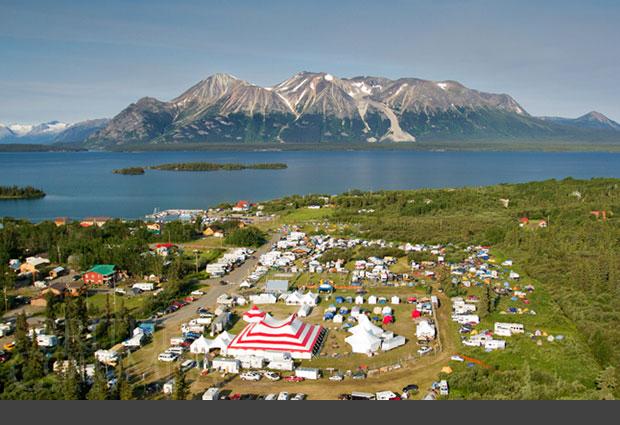
Among them was Atlin, British Columbia. Atlin lies on a lake of the same name, one of the narrow lakes north of the Coast Mountains that feeds the Yukon.
While Juneau, Alaska's capital, is only a short distance away over the Coast Mountains, the Taku Icefield and jagged peaks mean that it is remote in real terms.
Despite the rugged and mountainous setting, Atlin's growth into a sizable mining settlement was driven as much by its convenience to gold rush transportation routes as the richness of its fields.
Lake Atlin and its sister Lake Teslin are at the end of the historical Yukon Telegraph Route, a trail (very roughly) blazed north from Vancouver in the 1860's for a (never completed) overland telegraph intended to link North America with Russia. At the time of the gold rush, the closest developed settlements in British Columbia were on the Skeena river, at the southern end of the telegraph trail. A handful of gold rushers, many of them prospectors who'd been working claims in the Cassiar Mountains, as well as veterans of the Juneau and Stickeen gold rushes, worked their way north along the telegraph trail, either from the Skeena or after crossing the historical Tlingit "grease trails" on the Taku River at Juneau and the Stickeen at Wrangell, Alaska. It is a testament to the extreme ruggedness of British Columbia's northern mountains that only a handful made it, making the telegraph trail an even harder route to the Yukon than the infamous Peace River trail from Edmonton.

The somewhat beaten path to Atlin from Canadian goldfields to the south did not sustain the fledgling city, though. The vast majority of Klondikers accessed the Yukon from the twin ports of Skagway and Dyea at the end of the Lynn Canal. While the image many have of the Klondike Gold Rush is of stampeders trudging over the icy slopes of the Chilkoot Pass, by the end of 1898 the narrow-gauge White Pass and Yukon Route was complete from the port at Skagway to the head of navigation on the Yukon at Bennett, British Columbia. The WP&YR reached Whitehorse, the last set of rapids on the Yukon, just in time to see Dawson nearly abandoned as the prospectors, along with the merchants, bartenders, dancehall girls, and flimflam men who got rich off them, left the Klondike for new fields at Nome, Alaska.

Even after the frenzy of the Klondike rush subsided and Dawson shrank from a bustling city of 40,000 to a town of a few thousand where gold was laboriously extracted by placer mining instead of being picked out of the water in nuggets the size of a man's thumb, the WP&YR stayed solvent by helping Dawson supply itself and send its gold to the sea via Yukon river steamers to Whitehorse. Atlin, like Dawson, used a combination of water and rail to sustain its goldfields. Lake steamers crossed Atlin lake and Tagish Lake, from where goods could be loaded onto the WP&YR train, with a short rail portage connection between the two. Atlin's peak of success in the early 20th century came less from its gold and more from its spectacular setting. Known as "Little Switzerland" for the spectacular views of glaciated peaks and blue lakes, tourists on Inside Passage cruises would take the WP&YR from Skagway and boat across the lakes, where they could enjoy a play at the Globe Theater, world-class sheep and moose hunting, and the thrill of adventure of being ensconced in luxury in the remote North.

The conquest of that very remoteness was a high priority in Canada at the time. The Grand Trunk Pacific Railway, completed in 1914, connected Prince Rupert with the rest of Canada. In British Columbia, having two great Pacific ports at the terminus of two transcontinental railroads was seen as a sign of the province's future greatness, and the British Columbia government chartered the Pacific Great Eastern to build a route north linking the new railroad with Vancouver. Even with government support, the PGE struggled to pay its bills, and the route from Vancouver to Prince George developed slowly. By 1918, the government had to take over the struggling line, just as the Federal government had nationalized the Canadian Northern in 1918.
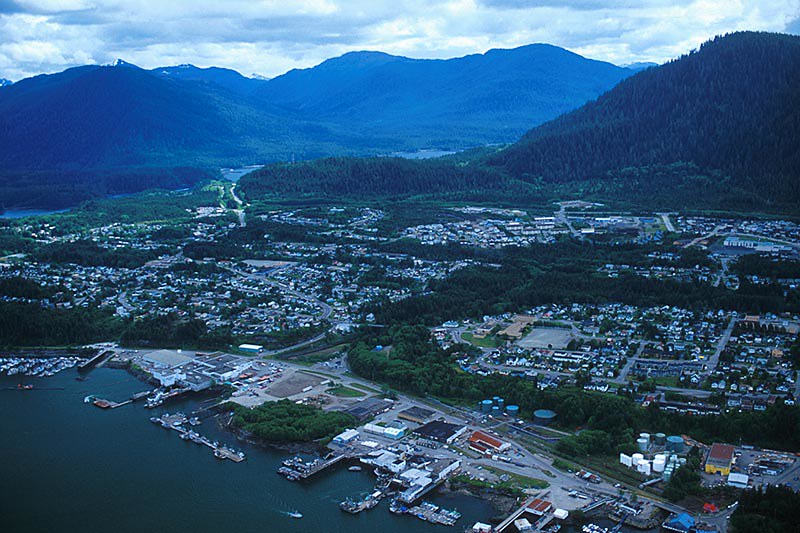
Prince Rupert, BC
The newly nationalized PGE had been struggling to link several sections between Vancouver and the Cariboo country. The Cariboo itself, the path along the Fraser river between the two transcontinental routes, had largely been untouched. Liberal Premier Harlan Carey Brewster identified the Cariboo section of the railway as the critical section for the province's future. Rather than have the province pay, he chartered a new railway company which would be funded through the traditional method of land sales. The Fraser Northern railway corporation, founded with U.S. capital, began construction from Clinton and Prince George in fall of 1918 and had driven the final spike at Williams Lake by 1921.*

BC Premier Harlan Carey Brewster
The success of the Fraser Northern led a number of Canadian businessmen and politicians to cast their eyes further north to the undeveloped Cassiar country, with its abundant gold and timber. In 1920, the province chartered the Skeena and Yukon Railroad corporation to build a railroad line along the Klondike telegraph line from Hazleton on the GTPR to Atlin. The new railroad would open a significant part of the Yukon to development, but its appeal lay in equal part with tourism as with gold and timber. Skeena and Yukon executives and shareholders pictured twenty Atlins in the Cassiar, each of them full of well-heeled tourists staying at company-owned luxury hotels.

The GTRP map, including the Skeena and Yukon Route all the way to Dawson City.
Rugged terrain and extreme weather made the construction of the Skeena and Yukon route challenging. Work from the northern end at Atlin was extra complicated due to the lack of a direct rail or water route. After numerous struggles, the first standard-gauge train reached the new rail yards at Atlin in 1925. The Skeena and Yukon, not content to rest on its laurels, looked even further up the Yukon to Dawson City, on the model of the Alaska Railroad making its way north from the Kenai peninsula to Fairbanks at the same time. The BC government was reluctant to charter a route into Yukon, but the White Pass & Yukon Route and the Skeena and Yukon partnered to survey a standard-gauge line that could run between Atlin and Whitehorse.

Besides the main rail yards at Atlin and Hazleton, the settlement of Telegraph Creek was the maintenance and logistics hub of the Skeena and Yukon. The railroad brought hundreds of jobs to the town even after their army of Chinese workers had been shipped back home, and trappers and prospectors used the new town as a base for exploring the wild hinterlands of northwestern British Columbia.

The promised chain of luxury resorts, however, never materialized, nor did the railroad to Dawson. The Great Depression struck just as the Skeena and Yukon Route was beginning to get into full operations, and the Atlin tourist trade evaporated. The Skeena and Yukon declared bankruptcy in 1929, as did the Fraser Northern. The BC government was saddled with both, along with the PGE they had controlled since 1918. The Skeena and Yukon continued to run trains in summertime, but Atlin and Telegraph Creek dwindled nearly to ghost towns.

British Columbia's ambition to connect Vancouver with Atlin had been minor compared with the international ambitions of some other railroad companies. A route had begun from Edmonton to Dawson in 1898, but work petered out with the rapid success of the White Pass and Yukon Route. A line was built from Edmonton to Dawson's Creek, BC, on the Peace River, but few capitalists leaped at the opportunity to complete the line to Alaska. In fact, the earliest vision for the PGE railway had envisioned it reaching all the way to mainland Alaska. The Alaska Railroad, owned by the U.S. federal government, ended at Fairbanks, but partners were earnestly sought to extend it into Canada. The prospect of a Canadian partnership meant that the Alaska state government extended the railroad all the way to Circle, on the Yukon River.

In the late 1930's, opportunity again showed itself. The U.S. and Canadian government began to look at the prospect of a Japanese invasion of the West Coast. To defend Alaska, the U.S. government needed an overland road link. Discussions and planning began in earnest in the late 1930's and an agreement was nailed down almost simultaneously with the outbreak of war. The U.S. government would construct the road entirely at its own expense and hand it over to Canada at the conclusion of hostilities.
Several different options were available for the Alaska Highway. Building a road along the Skeena and Yukon Route was ruled out quickly due to difficult weather and its proximity to the Pacific Coast. The British Columbia government favored a route straight north from Prince George and up the Rocky Mountain Trench all the way to Dawson. The most logical route, however, went up the Peace River from Dawson Creek to Whitehorse.

Route A shows the Skeena and Yukon Route, Route B is the suggested route north from Prince George. The actual Alaska Highway route is not shown.
From Whitehorse, the Canadians favored a route directly to Dawson City, Yukon's second city, which would involve several river crossings on the Yukon. The Americans favored a route west to the base of the Kluane mountains and then north to the Tanana valley, avoiding the need to build bridges or use ferries across the mighty Yukon.** The existence of a surveyed route between Atlin and Dawson City, with the prospect of linking the Alaska Railroad postwar, was ultimately too appealing, and the Alaska highway went north from Whitehorse, crossing pontoon bridges at Carmacks, Pelly Crossing, Stewart Crossing, and Dawson City.*** From Dawson City, the road went along the Yukon to Circle, where it met the Alaska Railroad and Steese Highway to Fairbanks.

The new highway was constructed by over 10,000 American soldiers, working not only from the far ends at Circle and Dawson Creek but from the middle. The White Pass and Yukon Railroad was taken over by the Army and used to ship supplies and construction material from Skagway to Whitehorse. The Alaska Highway was completed in fall of 1942, though it was far from ready for significant traffic. The Army also constructed the long-awaited spur line from Atlin to Whitehorse, and the Skeena and Yukon route carried a significant amount of supplies for the road builders who continued to improve the road through the rest of the war.

U.S. military construction in Whitehorse
British Columbia boomed after the war, and the railroad line to Whitehorse meant that the north and Yukon boomed along with it. BC Rail constructed a link from Prince George to Dawson Creek and north to Fort Nelson on the Alaska Highway. BC Rail also partnered with the Yukon and Federal governments (who had taken possession of the Atlin-Whitehorse line) to build one from Whitehorse to Dawson City, which was completed in 1960. The old Skeena and Yukon line to Atlin would be owned entirely by BC Rail, and the track from Atlin to Dawson City by Yukon Rail, a new entity controlled jointly by the federal, Yukon, and BC governments.

The U.S. federal government retained ownership of the Alaska Railroad after Alaska statehood, and it partnered with Yukon Rail to complete the link from Circle to Dawson City with funding from the Department of Defense. Circle Army Airfield, later Circle Air Force Base, was a significant part of the Cold War defense plans for Alaska. The Canadian Army's Yukon Regiment, formed in 1967, was a reserve battalion with companies at Whitehorse, Carmacks, and Dawson City. Their wartime plan was to reinforce the Army and Alaska National Guard along Alaska's highway system when hordes of Communist paratroopers came pouring into Alaska. A company of Rocky Mountain Rangers from Atlin was intended to support the amphibious National Guard battalion based out of Juneau.

Despite being off the Alaska Highway, Atlin flourished with tourist trade, particularly after the Yukon government completed the spur road off the Tagish/Carcross highway. The northwest BC region was even further energized in the early 1980's when the highway from Juneau to Atlin was completed. Road access to Prince George remained difficult, but significant amounts of shipping and cruise ship passengers could use the port of Juneau. Inside Passage excursions could be extended by replacing the standard overnight trip from Juneau to Skagway with a bus trip from Juneau to Atlin, followed by a scenic railroad trip from Atlin to Whitehorse and another south over the White Pass back to Skagway.

The establishment of a chain of national historical sites commemorating the Klondike Gold Rush in both the U.S. and Canada was followed by 1980's binational declaration of Taku National Park (part of the Alaska National Interest Lands Conservation Act in the U.S.), a pair of jointly managed parks encompassing the Taku Icefield and stretching north to south from the Taku Valley Highway to the southern part of Atlin Lake. Though roadless and extremely rugged, a popular winter ski trail over the glacier from Atlin to Juneau is traveled by hundreds every year, and thousands more enjoy flightseeing of the park year round.

Without the vision of a rail link traversing British Columbia, Atlin could be nothing but one more semi-abandoned gold town in the North. British Columbia has no shortage of beautiful lakes surrounded by spectacular mountains, but the setting of Atlin is a uniquely charming one. The Skeena and Yukon Railroad plays a huge part in the history of this subarctic Switzerland.
Appendix: Selected cities and their year-round population
YUKON:
Whitehorse: 40,000
Dawson City: 8,000
Carmacks: 2,500
BRITISH COLUMBIA:
Atlin: 5,000
Telegraph Creek: 800
ALASKA:
Skagway: 1,200
Circle: 900
*This is the POD. I just made it up out of thin air knowing zero about BC politics or railroad business at this time, so a better one would be appreciated. OTL the nationalized BC Rail floundered until after WWII, at which point it went on a building boom which did not, however, include a Cassiar route. Rethinking this, I'd probably need the Skeena and Yukon route to be started before 1914 and completed by 1918, but eh, you get what you get, I wrote this in my head while driving.
**I think. I've never actually heard a satisfactory answer for why the Alaska Highway avoids Dawson City other than the bridge issue.
***This is the OTL Klondike Highway. The alternative route map I saw just follows the Yukon directly. No idea which the railroad would prefer.
****I've never heard a Dawson-Circle road or railroad seriously proposed. The existing road from Dawson to Alaska drops down the Tetlin valley right after crossing the border, but that's because the Alaska Highway is along the Tanana. If a highway along the Yukon is impossible, then you can say the road drops down to the Tanana at Tok and from there to Delta Junction without altering too much.
An Iron Road to Gold: The History of Canada's Northern Railway
The Klondike Gold Rush of 1898-1899 lies at the beginning of our story, as it does at the beginning of nearly every story about Canada's North. Inspired by the riches earned by the earliest claimants on the Klondike, those prospectors too late or unlucky to strike it rich at Dawson themselves searched nearly every tributary of the Yukon hoping the find a second Klondike. While no lode before or since could match the Klondike, a number of mining towns did spring up all over the North.
Among them was Atlin, British Columbia. Atlin lies on a lake of the same name, one of the narrow lakes north of the Coast Mountains that feeds the Yukon.
While Juneau, Alaska's capital, is only a short distance away over the Coast Mountains, the Taku Icefield and jagged peaks mean that it is remote in real terms.
Despite the rugged and mountainous setting, Atlin's growth into a sizable mining settlement was driven as much by its convenience to gold rush transportation routes as the richness of its fields.
Lake Atlin and its sister Lake Teslin are at the end of the historical Yukon Telegraph Route, a trail (very roughly) blazed north from Vancouver in the 1860's for a (never completed) overland telegraph intended to link North America with Russia. At the time of the gold rush, the closest developed settlements in British Columbia were on the Skeena river, at the southern end of the telegraph trail. A handful of gold rushers, many of them prospectors who'd been working claims in the Cassiar Mountains, as well as veterans of the Juneau and Stickeen gold rushes, worked their way north along the telegraph trail, either from the Skeena or after crossing the historical Tlingit "grease trails" on the Taku River at Juneau and the Stickeen at Wrangell, Alaska. It is a testament to the extreme ruggedness of British Columbia's northern mountains that only a handful made it, making the telegraph trail an even harder route to the Yukon than the infamous Peace River trail from Edmonton.
The somewhat beaten path to Atlin from Canadian goldfields to the south did not sustain the fledgling city, though. The vast majority of Klondikers accessed the Yukon from the twin ports of Skagway and Dyea at the end of the Lynn Canal. While the image many have of the Klondike Gold Rush is of stampeders trudging over the icy slopes of the Chilkoot Pass, by the end of 1898 the narrow-gauge White Pass and Yukon Route was complete from the port at Skagway to the head of navigation on the Yukon at Bennett, British Columbia. The WP&YR reached Whitehorse, the last set of rapids on the Yukon, just in time to see Dawson nearly abandoned as the prospectors, along with the merchants, bartenders, dancehall girls, and flimflam men who got rich off them, left the Klondike for new fields at Nome, Alaska.
Even after the frenzy of the Klondike rush subsided and Dawson shrank from a bustling city of 40,000 to a town of a few thousand where gold was laboriously extracted by placer mining instead of being picked out of the water in nuggets the size of a man's thumb, the WP&YR stayed solvent by helping Dawson supply itself and send its gold to the sea via Yukon river steamers to Whitehorse. Atlin, like Dawson, used a combination of water and rail to sustain its goldfields. Lake steamers crossed Atlin lake and Tagish Lake, from where goods could be loaded onto the WP&YR train, with a short rail portage connection between the two. Atlin's peak of success in the early 20th century came less from its gold and more from its spectacular setting. Known as "Little Switzerland" for the spectacular views of glaciated peaks and blue lakes, tourists on Inside Passage cruises would take the WP&YR from Skagway and boat across the lakes, where they could enjoy a play at the Globe Theater, world-class sheep and moose hunting, and the thrill of adventure of being ensconced in luxury in the remote North.
The conquest of that very remoteness was a high priority in Canada at the time. The Grand Trunk Pacific Railway, completed in 1914, connected Prince Rupert with the rest of Canada. In British Columbia, having two great Pacific ports at the terminus of two transcontinental railroads was seen as a sign of the province's future greatness, and the British Columbia government chartered the Pacific Great Eastern to build a route north linking the new railroad with Vancouver. Even with government support, the PGE struggled to pay its bills, and the route from Vancouver to Prince George developed slowly. By 1918, the government had to take over the struggling line, just as the Federal government had nationalized the Canadian Northern in 1918.
Prince Rupert, BC
The newly nationalized PGE had been struggling to link several sections between Vancouver and the Cariboo country. The Cariboo itself, the path along the Fraser river between the two transcontinental routes, had largely been untouched. Liberal Premier Harlan Carey Brewster identified the Cariboo section of the railway as the critical section for the province's future. Rather than have the province pay, he chartered a new railway company which would be funded through the traditional method of land sales. The Fraser Northern railway corporation, founded with U.S. capital, began construction from Clinton and Prince George in fall of 1918 and had driven the final spike at Williams Lake by 1921.*
BC Premier Harlan Carey Brewster
The success of the Fraser Northern led a number of Canadian businessmen and politicians to cast their eyes further north to the undeveloped Cassiar country, with its abundant gold and timber. In 1920, the province chartered the Skeena and Yukon Railroad corporation to build a railroad line along the Klondike telegraph line from Hazleton on the GTPR to Atlin. The new railroad would open a significant part of the Yukon to development, but its appeal lay in equal part with tourism as with gold and timber. Skeena and Yukon executives and shareholders pictured twenty Atlins in the Cassiar, each of them full of well-heeled tourists staying at company-owned luxury hotels.
The GTRP map, including the Skeena and Yukon Route all the way to Dawson City.
Rugged terrain and extreme weather made the construction of the Skeena and Yukon route challenging. Work from the northern end at Atlin was extra complicated due to the lack of a direct rail or water route. After numerous struggles, the first standard-gauge train reached the new rail yards at Atlin in 1925. The Skeena and Yukon, not content to rest on its laurels, looked even further up the Yukon to Dawson City, on the model of the Alaska Railroad making its way north from the Kenai peninsula to Fairbanks at the same time. The BC government was reluctant to charter a route into Yukon, but the White Pass & Yukon Route and the Skeena and Yukon partnered to survey a standard-gauge line that could run between Atlin and Whitehorse.
Besides the main rail yards at Atlin and Hazleton, the settlement of Telegraph Creek was the maintenance and logistics hub of the Skeena and Yukon. The railroad brought hundreds of jobs to the town even after their army of Chinese workers had been shipped back home, and trappers and prospectors used the new town as a base for exploring the wild hinterlands of northwestern British Columbia.
The promised chain of luxury resorts, however, never materialized, nor did the railroad to Dawson. The Great Depression struck just as the Skeena and Yukon Route was beginning to get into full operations, and the Atlin tourist trade evaporated. The Skeena and Yukon declared bankruptcy in 1929, as did the Fraser Northern. The BC government was saddled with both, along with the PGE they had controlled since 1918. The Skeena and Yukon continued to run trains in summertime, but Atlin and Telegraph Creek dwindled nearly to ghost towns.
British Columbia's ambition to connect Vancouver with Atlin had been minor compared with the international ambitions of some other railroad companies. A route had begun from Edmonton to Dawson in 1898, but work petered out with the rapid success of the White Pass and Yukon Route. A line was built from Edmonton to Dawson's Creek, BC, on the Peace River, but few capitalists leaped at the opportunity to complete the line to Alaska. In fact, the earliest vision for the PGE railway had envisioned it reaching all the way to mainland Alaska. The Alaska Railroad, owned by the U.S. federal government, ended at Fairbanks, but partners were earnestly sought to extend it into Canada. The prospect of a Canadian partnership meant that the Alaska state government extended the railroad all the way to Circle, on the Yukon River.
In the late 1930's, opportunity again showed itself. The U.S. and Canadian government began to look at the prospect of a Japanese invasion of the West Coast. To defend Alaska, the U.S. government needed an overland road link. Discussions and planning began in earnest in the late 1930's and an agreement was nailed down almost simultaneously with the outbreak of war. The U.S. government would construct the road entirely at its own expense and hand it over to Canada at the conclusion of hostilities.
Several different options were available for the Alaska Highway. Building a road along the Skeena and Yukon Route was ruled out quickly due to difficult weather and its proximity to the Pacific Coast. The British Columbia government favored a route straight north from Prince George and up the Rocky Mountain Trench all the way to Dawson. The most logical route, however, went up the Peace River from Dawson Creek to Whitehorse.
Route A shows the Skeena and Yukon Route, Route B is the suggested route north from Prince George. The actual Alaska Highway route is not shown.
From Whitehorse, the Canadians favored a route directly to Dawson City, Yukon's second city, which would involve several river crossings on the Yukon. The Americans favored a route west to the base of the Kluane mountains and then north to the Tanana valley, avoiding the need to build bridges or use ferries across the mighty Yukon.** The existence of a surveyed route between Atlin and Dawson City, with the prospect of linking the Alaska Railroad postwar, was ultimately too appealing, and the Alaska highway went north from Whitehorse, crossing pontoon bridges at Carmacks, Pelly Crossing, Stewart Crossing, and Dawson City.*** From Dawson City, the road went along the Yukon to Circle, where it met the Alaska Railroad and Steese Highway to Fairbanks.
The new highway was constructed by over 10,000 American soldiers, working not only from the far ends at Circle and Dawson Creek but from the middle. The White Pass and Yukon Railroad was taken over by the Army and used to ship supplies and construction material from Skagway to Whitehorse. The Alaska Highway was completed in fall of 1942, though it was far from ready for significant traffic. The Army also constructed the long-awaited spur line from Atlin to Whitehorse, and the Skeena and Yukon route carried a significant amount of supplies for the road builders who continued to improve the road through the rest of the war.
U.S. military construction in Whitehorse
British Columbia boomed after the war, and the railroad line to Whitehorse meant that the north and Yukon boomed along with it. BC Rail constructed a link from Prince George to Dawson Creek and north to Fort Nelson on the Alaska Highway. BC Rail also partnered with the Yukon and Federal governments (who had taken possession of the Atlin-Whitehorse line) to build one from Whitehorse to Dawson City, which was completed in 1960. The old Skeena and Yukon line to Atlin would be owned entirely by BC Rail, and the track from Atlin to Dawson City by Yukon Rail, a new entity controlled jointly by the federal, Yukon, and BC governments.
The U.S. federal government retained ownership of the Alaska Railroad after Alaska statehood, and it partnered with Yukon Rail to complete the link from Circle to Dawson City with funding from the Department of Defense. Circle Army Airfield, later Circle Air Force Base, was a significant part of the Cold War defense plans for Alaska. The Canadian Army's Yukon Regiment, formed in 1967, was a reserve battalion with companies at Whitehorse, Carmacks, and Dawson City. Their wartime plan was to reinforce the Army and Alaska National Guard along Alaska's highway system when hordes of Communist paratroopers came pouring into Alaska. A company of Rocky Mountain Rangers from Atlin was intended to support the amphibious National Guard battalion based out of Juneau.
Despite being off the Alaska Highway, Atlin flourished with tourist trade, particularly after the Yukon government completed the spur road off the Tagish/Carcross highway. The northwest BC region was even further energized in the early 1980's when the highway from Juneau to Atlin was completed. Road access to Prince George remained difficult, but significant amounts of shipping and cruise ship passengers could use the port of Juneau. Inside Passage excursions could be extended by replacing the standard overnight trip from Juneau to Skagway with a bus trip from Juneau to Atlin, followed by a scenic railroad trip from Atlin to Whitehorse and another south over the White Pass back to Skagway.
The establishment of a chain of national historical sites commemorating the Klondike Gold Rush in both the U.S. and Canada was followed by 1980's binational declaration of Taku National Park (part of the Alaska National Interest Lands Conservation Act in the U.S.), a pair of jointly managed parks encompassing the Taku Icefield and stretching north to south from the Taku Valley Highway to the southern part of Atlin Lake. Though roadless and extremely rugged, a popular winter ski trail over the glacier from Atlin to Juneau is traveled by hundreds every year, and thousands more enjoy flightseeing of the park year round.
Without the vision of a rail link traversing British Columbia, Atlin could be nothing but one more semi-abandoned gold town in the North. British Columbia has no shortage of beautiful lakes surrounded by spectacular mountains, but the setting of Atlin is a uniquely charming one. The Skeena and Yukon Railroad plays a huge part in the history of this subarctic Switzerland.
Appendix: Selected cities and their year-round population
YUKON:
Whitehorse: 40,000
Dawson City: 8,000
Carmacks: 2,500
BRITISH COLUMBIA:
Atlin: 5,000
Telegraph Creek: 800
ALASKA:
Skagway: 1,200
Circle: 900
*This is the POD. I just made it up out of thin air knowing zero about BC politics or railroad business at this time, so a better one would be appreciated. OTL the nationalized BC Rail floundered until after WWII, at which point it went on a building boom which did not, however, include a Cassiar route. Rethinking this, I'd probably need the Skeena and Yukon route to be started before 1914 and completed by 1918, but eh, you get what you get, I wrote this in my head while driving.
**I think. I've never actually heard a satisfactory answer for why the Alaska Highway avoids Dawson City other than the bridge issue.
***This is the OTL Klondike Highway. The alternative route map I saw just follows the Yukon directly. No idea which the railroad would prefer.
****I've never heard a Dawson-Circle road or railroad seriously proposed. The existing road from Dawson to Alaska drops down the Tetlin valley right after crossing the border, but that's because the Alaska Highway is along the Tanana. If a highway along the Yukon is impossible, then you can say the road drops down to the Tanana at Tok and from there to Delta Junction without altering too much.